2007
NU2231 : Annstead Burn
taken 17 years ago, near to Seahouses, Northumberland, England
This is 1 of 7 images, with title Annstead Burn in this square
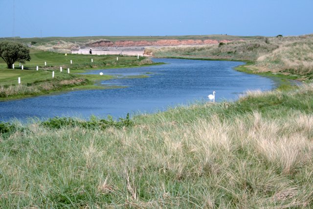
Annstead Burn
Separating the golf course on the left with the nature reserve of Annstead Links on the right.
 Map © Crown Copyright")
TIP: Click the map for more Large scale mapping
- Grid Square
- NU2231, 202 images (more nearby 🔍)
- Photographer
- Mick Garratt (more nearby)
- Date Taken
- Saturday, 5 May, 2007 (more nearby)
- Submitted
- Tuesday, 8 May, 2007
- Subject Location
-
OSGB36:
 NU 223 310 [100m precision]
WGS84: 55:34.3726N 1:38.8361W - Camera Location
-
OSGB36: NU 222 310
- View Direction
- Northeast (about 45 degrees)