2014
NU1434 : Waren Mill from Budle Bay
taken 12 years ago, near to Waren Mill, Northumberland, England
This is 1 of 17 images, with title starting with Waren Mill in this square
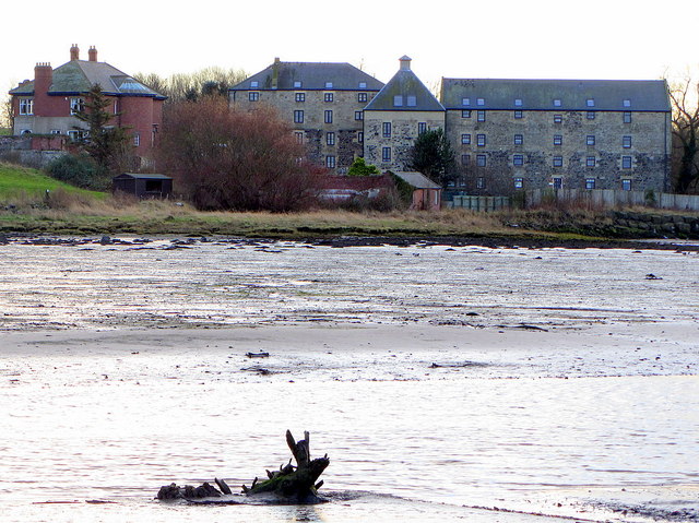
Waren Mill from Budle Bay
The collection of buildings dates from 1783 but incorporate parts of former mill on the same site. It includes a corn mill (originally water powered, five storeys and four bays); miller's house (two storeys); malting kiln (three storeys with a conical roof); granary (four storeys and five bays added 1924).
The mill was originally water powered, the mill-race, taking water from Waren Burn about 1km upstream in the vicinity of Spindlestone Mill, passed through the east end of the complex. It was converted to steam power in 1819. It is thought to have been supplied by coal and corn brought in by sea, with malt and flour leaving by the same route. A turbine eventually replaced the waterwheel and the mill then became powered by electricity.
The mill was closed down c1980 and converted into domestic accommodation c1985.
Some dates in the history of the mill are given on a plaque on the outer wall NU1434 : Plaque in wall, Waren Mill
Waren Mill is a Listed Building Grade II.
Historic England: Link
Islandshire Archives: Link Archive Link
See other images of Waren Mill
The mill was originally water powered, the mill-race, taking water from Waren Burn about 1km upstream in the vicinity of Spindlestone Mill, passed through the east end of the complex. It was converted to steam power in 1819. It is thought to have been supplied by coal and corn brought in by sea, with malt and flour leaving by the same route. A turbine eventually replaced the waterwheel and the mill then became powered by electricity.
The mill was closed down c1980 and converted into domestic accommodation c1985.
Some dates in the history of the mill are given on a plaque on the outer wall NU1434 : Plaque in wall, Waren Mill
Waren Mill is a Listed Building Grade II.
Historic England: Link
Islandshire Archives: Link
Archive LinkSee other images of Waren Mill


TIP: Click the map for more Large scale mapping
- Grid Square
- NU1434, 165 images (more nearby 🔍)
- Photographer
- Andrew Curtis (more nearby)
- Date Taken
- Friday, 12 December, 2014 (more nearby)
- Submitted
- Sunday, 14 December, 2014
- Subject Location
-
OSGB36:
 NU 1467 3437
[10m precision]
WGS84: 55:36.1636N 1:46.1239W - Camera Location
-
OSGB36:
NU 14760 34738
- View Direction
- South-southwest (about 202 degrees)


