2014
SJ7661 : Former Sandbach Waterworks building
taken 9 years ago, near to Sandbach, Cheshire East, England
This is 1 of 2 images, with title Former Sandbach Waterworks building in this square
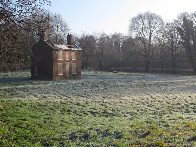
Former Sandbach Waterworks building
Old maps show this area as a waterworks. According to Stewart Green's local history site Link , both the water (abstraction) works here, and the sewage works further downstream, were opened in 1891 at the same time that the Dingle fishing lake was formed.
This was presumably the administrative building. By 2014 it was derelict and planning permission (Ref 12/1650C) was granted for its demolition, removal of water treatment storage and settlement tanks, and construction of 12 two-storey detached dwellings. See also SJ7661 : Former Sandbach Waterworks building.
This was presumably the administrative building. By 2014 it was derelict and planning permission (Ref 12/1650C) was granted for its demolition, removal of water treatment storage and settlement tanks, and construction of 12 two-storey detached dwellings. See also SJ7661 : Former Sandbach Waterworks building.
 Map © Crown Copyright")
TIP: Click the map for more Large scale mapping
- Grid Square
- SJ7661, 169 images (more nearby 🔍)
- Photographer
- Stephen Craven (more nearby)
- Date Taken
- Sunday, 28 December, 2014 (more nearby)
- Submitted
- Thursday, 1 January, 2015
- Subject Location
-
OSGB36:
 SJ 7636 6111 [10m precision]
WGS84: 53:8.7962N 2:21.2939W - Camera Location
-
OSGB36: SJ 7633 6113
- View Direction
- East-southeast (about 112 degrees)