2014
SJ8862 : Macclesfield Canal at Dane-in-Shaw
taken 9 years ago, near to Hightown, Cheshire East, England
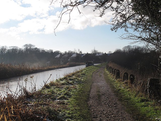
Macclesfield Canal at Dane-in-Shaw
The canal crosses Dane-in-Shaw Brook on a high embankment. Why it was not an aqueduct, I do not know.
The Macclesfield Canal
The Macclesfield Canal is just over 27 miles in length, and has thirteen locks, including the stop lock at Hall Green and the other twelve at Bosley. The canal was surveyed by Thomas Telford in 1825, then engineered by William Crosley, and opened on 9 November 1831 at a cost of £320,000. It joins the Trent and Mersey Canal at Hall Green to the Peak Forest Canal at Marple.
 Map © Crown Copyright")
TIP: Click the map for more Large scale mapping
- Grid Square
- SJ8862, 43 images (more nearby 🔍)
- Photographer
- Stephen Craven (more nearby)
- Date Taken
- Monday, 29 December, 2014 (more nearby)
- Submitted
- Thursday, 1 January, 2015
- Subject Location
-
OSGB36:
 SJ 880 624 [100m precision]
WGS84: 53:9.5424N 2:10.8552W - Camera Location
-
OSGB36: SJ 880 625
- View Direction
- South-southwest (about 202 degrees)