NT3170 : Looking north from the Shawfair Bridge
taken 9 years ago, near to Danderhall, Midlothian, Scotland
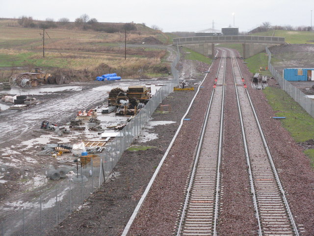
The old Waverley Line, which closed in 1969, is being resurrected as the Borders Railway, going 30 miles from Edinburgh to Tweedbank [between Galashiels and Melrose], with 7 new stations, and using 90% of the former route. Full details and progress can be found at Link
. Construction is scheduled to be completed by summer 2015, and the estimated cost, at 2012 prices, is £294 million. The project does not extend the route to the original destination at Carlisle.
The website says that test trains will run from June 2015, and it has been announced that the first passenger trains will run on 6 September 2015, with a grand opening. There are also plans for a 'steam train experience' and the possibility of the permanent exhibition of the Great Tapestry of Scotland at Tweedbank Station to boost tourism and use of the line.
The line opened for passenger traffic on 6 September 2015, with an half-hourly service on weekdays and Saturdays, and an hourly service on Sundays, with a journey time of about 1 hour. It was officially opened by HM The Queen on 9 September 2015, on the day that she became the longest serving UK Monarch; she travelled from Edinburgh to Tweedbank on a train steam-hauled by the 'Union of South Africa', with a stop st Newtongrange to unveil a plaque.
 Map © Crown Copyright")
- Grid Square
- NT3170, 39 images (more nearby 🔍)
- Photographer
- M J Richardson (more nearby)
- Date Taken
- Friday, 9 January, 2015 (more nearby)
- Submitted
- Friday, 9 January, 2015
- Subject Location
-
OSGB36:
 NT 3195 7020 [10m precision]
WGS84: 55:55.2030N 3:5.4257W - Camera Location
-
OSGB36: NT 3197 7005
- View Direction
- NORTH (about 0 degrees)