SJ8499 : Crane at Manchester Victoria station
taken 10 years ago, near to Manchester, England
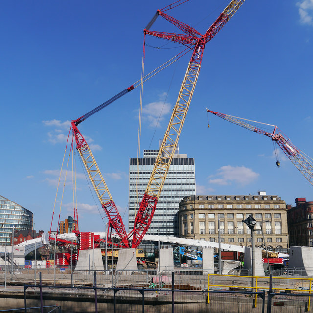
The view is from platform 1, across the Metrolink stop platforms towards CIS Tower
The Metrolink is a light rail system. The network consists of eight lines which radiate from Manchester city centre to termini at Altrincham, Ashton-under-Lyne, Bury, East Didsbury, Eccles, Manchester Airport, Rochdale and The Trafford Centre.
Wikipedia: Link
Website: Link
Opened in 1844 (the present building dates to 1902), Manchester Victoria is the second busiest station in Manchester. It runs services mainly to destinations north and east of Manchester as well as Liverpool. There is also a Metrolink station on the line to Bury. The station underwent a major refurbishment between 2013-15, see ( Link )
Grade II listed. Link
Wikipedia: Link
Built in 1844, Manchester Victoria is a transport interchange station for train, tram and bus welcoming over six million passengers annually; various parts of the Victoria building are Grade II listed. In 2009, Victoria had the unfortunate distinction of being labelled Britains worst station (DfTs Better Stations report). Coupled with that, the station roof, which was a muddle of a design, was in very poor condition, a situation exacerbated by the IRA bomb in 1996 that caused significant damage in the centre of the city. The facilities met neither basic passenger expectations nor did they project the welcoming modern image expected by the many visitors arriving into Manchester in the twenty-first century.
Work to refurbish the station finally began in 2013. The refurbishment, which is scheduled to take until 2015, involves:
Improvements to the footbridge spanning platforms 3-6 allowing for future growth in passenger numbers
The old leaky roof replaced with a stunning new roof structure made from ETFE, the same material used at the Eden Project and the roof at Manchester Piccadilly station
Sympathetic refurbishment to Grade II listed parts of the Victoria Buildings, (including the war memorial, glass dome, Soldiers Gate and the wall map) restoring them to their former glory
Refurbishment of the external glass canopy, new lighting and glazed entrances to revitalise the Victoria Buildings
Revamp of existing retail spaces and provision of new retail facilities for a better shopping experience
Improvements to the ticket hall and external improvements to the paving on station approach
The Metrolink facilities in Victoria are being upgraded to provide additional capacity as the network expands, this work is being incorporated into the re-roofing works
Electrified rail lines to the station
(Link
The Co-operative Society, which owns much of the land in the area, intends to build a new 14-storey hotel alongside the station.
Update: The station was officially reopened (although it was never actually closed) by Transport Secretary Patrick McLoughlin on 6 October 2015 (Link
 Map © Crown Copyright")
- Grid Square
- SJ8499, 714 images (more nearby 🔍)
- Photographer
- Phil Champion (more nearby)
- Date Taken
- Tuesday, 22 July, 2014 (more nearby)
- Submitted
- Tuesday, 13 January, 2015
- Subject Location
-
OSGB36:
 SJ 8406 9902 [10m precision]
WGS84: 53:29.2589N 2:14.5018W - Camera Location
-
OSGB36: SJ 84043 99047
- View Direction
- Southeast (about 135 degrees)