2014
SJ9984 : Peak Forest Canal at New Town, Derbyshire
taken 10 years ago, near to Newtown, Derbyshire, England
This is 1 of 2 images, with title Peak Forest Canal at New Town, Derbyshire in this square
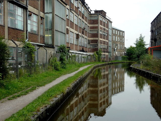
Peak Forest Canal at New Town, Derbyshire
The much extended Brunswick Mill, which now houses the Swizzels-Matlow sweet factory, is on the left.
April 1981: SJ9984 : Bridge 28, Peak Forest Canal, New Mills
David Dixon notes:
April 1981: SJ9984 : Bridge 28, Peak Forest Canal, New Mills
David Dixon notes:
Peak Forest Canal
The Peak Forest Canal runs for 15 miles between Ashton under Lyne and Whaley Bridge.
It was built to link the Ashton Canal with the tramways that brought limestone from the Peak District quarries.
The Lower Peak Forest Canal forms part of the "Cheshire Ring".
LinkPennine Waterways website including a "virtual tour" of the canal
Link
 Map © Crown Copyright")
TIP: Click the map for more Large scale mapping
- Grid Square
- SJ9984, 94 images (more nearby 🔍)
- Photographer
- Roger D Kidd (more nearby)
- Date Taken
- Friday, 5 September, 2014 (more nearby)
- Submitted
- Wednesday, 14 January, 2015
- Subject Location
-
OSGB36:
 SJ 9963 8489 [10m precision]
WGS84: 53:21.6531N 2:0.4214W - Camera Location
-
OSGB36: SJ 9959 8487
- View Direction
- East-northeast (about 67 degrees)