SJ7948 : Bateswood Country Park: very low water level of lake
taken 14 years ago, near to Halmer End, Staffordshire, England
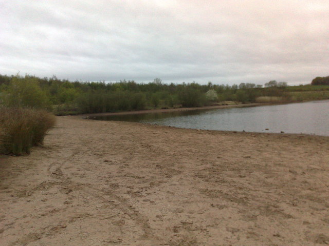
Bateswood Country Park, north-west of Newcastle-under-Lyme in Staffordshire and adjacent to the village of Halmer End, is designated as a Local Nature Reserve (LNR). It was developed after the cessation of opencast mining in the 1990s, which left the area as a barren wasteland with poor quality soil. Birch reforestation and the creation of a lake have improved the habitat for wildlife, while a network of footpaths and a bridle path create access to most parts of the site. In 2012 managed fishing by a local angling club was permitted, in an attempt to curb illicit fishing.
The site is managed by Newcastle Borough Council in partnership with Halmer End Wildlife Trust, a group of volunteers.
This site is not to be confused with Staffordshire Wildlife Trust's reserve immediately to the south, also called Bateswood (see Link.
 Map © Crown Copyright")
- Grid Square
- SJ7948, 216 images (more nearby 🔍)
- Photographer
- Jonathan Hutchins (more nearby)
- Date Taken
- Thursday, 29 April, 2010 (more nearby)
- Submitted
- Saturday, 17 January, 2015
- Subject Location
-
OSGB36:
 SJ 7950 4873 [10m precision]
WGS84: 53:2.1270N 2:18.4295W - Camera Location
-
OSGB36: SJ 7951 4876
- View Direction
- South-southwest (about 202 degrees)