2015
TQ3682 : Segregated paths, Mile End Park
taken 12 years ago, near to Stepney, Tower Hamlets, England
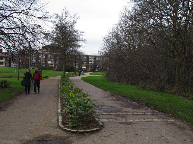
Segregated paths, Mile End Park
The spine path that runs sinuously through the linear park consists of parallel paths for walkers and cyclists. The cycle route (right) forms part of National Cycle Network route 1.

Mile End Millennium Park (provided by N Chadwick)
Mile End Park is a park located in the London Borough of Tower Hamlets. It is a linear park of some 32 ha and was created on industrial land devastated by World War II bombing. It lies on land to the east of the Regent's Canal and in the north, is separated from the southern edge of Victoria Park by the Hertford Union Canal. Mile End Stadium is part of the park.
Wikipedia: Link


TIP: Click the map for more Large scale mapping
- Grid Square
- TQ3682, 557 images (more nearby 🔍)
- Photographer
- Stephen Craven (more nearby)
- Date Taken
- Sunday, 11 January, 2015 (more nearby)
- Submitted
- Saturday, 17 January, 2015
- Subject Location
-
OSGB36:
 TQ 3642 8216
[10m precision]
WGS84: 51:31.3134N 0:2.1046W - Camera Location
-
OSGB36:
TQ 3645 8215
- View Direction
- West-northwest (about 292 degrees)


