SK2472 : Bubnell Hall
taken 9 years ago, near to Baslow, Derbyshire, England
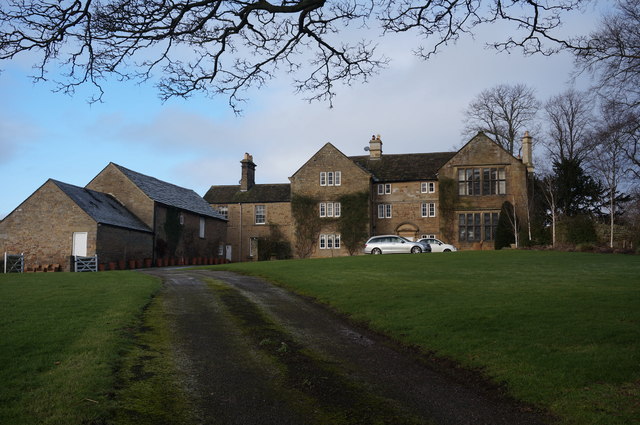
British Listed Buildings site Link
A listed building in the UK is one which is on the Statutory List of Buildings of Special Architectural or Historic Interest.
A listed building may not be demolished, extended or altered without special permission from the local planning authority (who typically consult the relevant central government agency, particularly for significant alterations to the more notable listed buildings).
For a building to be included on the list, it must be a man-made structure that survives in something at least approaching its original state. Most structures on the list are buildings, but other structures such as bridges, monuments, sculptures, war memorials, and even milestones and mileposts may also be listed. Some structures can also be classified as Scheduled Ancient Monuments rather than Listed Buildings.
These notes from Link
 Map © Crown Copyright")
- Grid Square
- SK2472, 52 images (more nearby 🔍)
- Photographer
- Peter Barr (more nearby)
- Date Taken
- Monday, 19 January, 2015 (more nearby)
- Submitted
- Wednesday, 21 January, 2015
- Subject Location
-
OSGB36:
 SK 2485 7256 [10m precision]
WGS84: 53:14.9687N 1:37.7420W - Camera Location
-
OSGB36: SK 2493 7252
- View Direction
- West-northwest (about 292 degrees)