2015
NT3227 : Hill track to Snouthead
taken 9 years ago, near to Yarrow Feus, Scottish Borders, Scotland
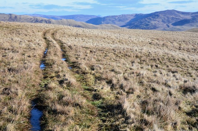
Hill track to Snouthead
A track crossing the unnamed grassy summit on the ridge to Snouthead. The small conical peak ahead in the distance is probably one of the Eildon Hills about 22km away.
 Map © Crown Copyright")
TIP: Click the map for more Large scale mapping
- Grid Square
- NT3227, 11 images (more nearby 🔍)
- Photographer
- Jim Barton (more nearby)
- Date Taken
- Tuesday, 10 February, 2015 (more nearby)
- Submitted
- Wednesday, 11 February, 2015
- Subject Location
-
OSGB36:
 NT 3260 2759 [10m precision]
WGS84: 55:32.2413N 3:4.1707W - Camera Location
-
OSGB36: NT 3257 2758
- View Direction
- East-northeast (about 67 degrees)