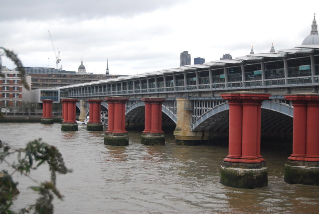
TQ3180 : Blackfriars Station and Railway Bridge
taken 9 years ago, near to London, The City of London, England

Blackfriars Station opened as St Paul's Station in 1886. Built by the London, Chatham & Dover Railway (who also constructed the railway bridge). Renamed Blackfriars in 1937. The station was rebuilt and reopened along with an underground station in 1977. The main service using the station is the Thameslink service which includes trains to and from Bedford, St Albans City and Luton in the north; and Brighton, Sutton and Sevenoaks in the south. The station has now been extended onto Blackfriars railway Bridge.
There have been two structures with the name. The first bridge was opened in 1864 and was designed by Joseph Cubitt for the London, Chatham and Dover Railway. Massive abutments at each end carried the railway's insignia, preserved and restored on the south side. It eventually became too weak to support modern trains, and was removed in 1985 - all that remains is a series of columns crossing the Thames and the southern abutment, which is a Grade II listed structure Link
. The remaining bridge, built slightly further downstream (to the east), was originally called St Paul's Railway Bridge and opened in 1886. It was designed by John Wolfe-Barry and Henry Marc Brunel and is made of wrought iron.
