1964
TQ7267 : Medway Bridge and M2
taken 60 years ago, near to Cuxton, Medway, England
This is 1 of 2 images, with title Medway Bridge and M2 in this square
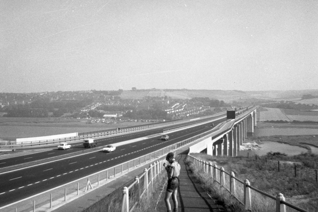
Medway Bridge and M2
The original Medway Bridge was built jointly by J.L.Kier & Co. and Christiani and Nielsen Ltd. whose estimated cost of two and one third million pounds was accepted by the Ministry for Transport in August 1960. It was constructed from prestressed concrete and is cantilevered. The overall length, excluding embankments is 3340 ft., with a main span of 500 ft. and anchor spans of 312ft. 6in. The height of the road surface above mean tide level is 116 ft. In addition there are 18 viaduct spans. Foundations and piles driven down into bedrock chalk provide support. There is a foot and cycle path alongside the M2 road.
 Map © Crown Copyright")
TIP: Click the map for more Large scale mapping
- Grid Square
- TQ7267, 132 images (more nearby 🔍)
- Photographer
- Andy Parrett (more nearby)
- Date Taken
- 2 September 1964 (more nearby)
- Submitted
- Monday, 16 February, 2015
- Subject Location
-
OSGB36:
 TQ 7233 6706 [10m precision]
WGS84: 51:22.5863N 0:28.4823E - Camera Location
-
OSGB36: TQ 7201 6747
- View Direction
- Southeast (about 135 degrees)