2014
SU5806 : Union Street
taken 10 years ago, near to Wallington, Hampshire, England
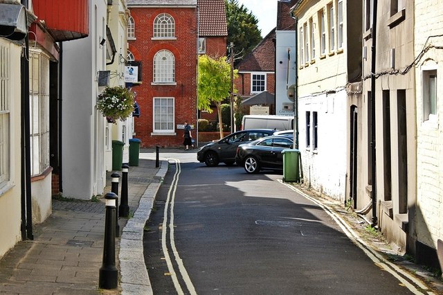
Union Street
The wide southern end of the High Street, at the junction with West Street and East Street, lends itself to market trading. The island buildings at the centre of the road would have been to facilitate this. Today, the narrower of the two roads is known as Union Street, taking its name from the Parish Union Workhouse, which was located at no 2.
 Map © Crown Copyright")
TIP: Click the map for more Large scale mapping
- Grid Square
- SU5806, 386 images (more nearby 🔍)
- Photographer
- Mack McLane (more nearby)
- Date Taken
- Saturday, 23 August, 2014 (more nearby)
- Submitted
- Friday, 20 February, 2015
- Subject Location
-
OSGB36:
 SU 5825 0623 [10m precision]
WGS84: 50:51.1597N 1:10.4324W - Camera Location
-
OSGB36: SU 5825 0623
- View Direction
- SOUTH (about 180 degrees)