2015
TL8008 : Church of All Saints - Ulting
taken 9 years ago, near to Ulting, Essex, England
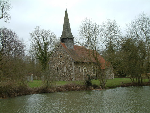
Church of All Saints - Ulting
This riverside church dates back to the 13th century, with some 19th century restoration and improvements. It became a listed building in 1959, and the construction is described as "Flint, puddingstone, septaria and brick. Red plain tiled roof, pierced ridge tiles. Weatherboarded and shingled spire."
 Map © Crown Copyright")
TIP: Click the map for more Large scale mapping
- Grid Square
- TL8008, 32 images (more nearby 🔍)
- Photographer
- Robin Lucas (more nearby)
- Date Taken
- Thursday, 26 February, 2015 (more nearby)
- Submitted
- Monday, 2 March, 2015
- Subject Location
-
OSGB36:
 TL 8013 0876 [10m precision]
WGS84: 51:44.9145N 0:36.4804E - Camera Location
-
OSGB36: TL 8008 0874
- View Direction
- East-northeast (about 67 degrees)