2015
TA0123 : Far Ings National Nature Reserve
taken 9 years ago, near to Humber Bridge, East Riding of Yorkshire, England
This is 1 of 3 images, with title Far Ings National Nature Reserve in this square
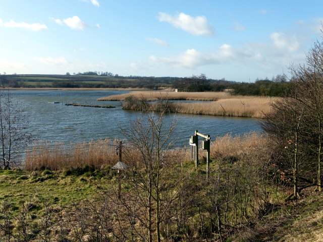
Far Ings National Nature Reserve
The reserve is made up of a series of former clay pits that have been flooded to create reed beds. It is regarded as one of the finest nature reserves in Lincolnshire.
 Map © Crown Copyright")
TIP: Click the map for more Large scale mapping
- Grid Square
- TA0123, 148 images (more nearby 🔍)
- Photographer
- Graham Hogg (more nearby)
- Date Taken
- Monday, 23 February, 2015 (more nearby)
- Submitted
- Tuesday, 3 March, 2015
- Subject Location
-
OSGB36:
 TA 0170 2332 [10m precision]
WGS84: 53:41.7856N 0:27.6692W - Camera Location
-
OSGB36: TA 0165 2337
- View Direction
- Southeast (about 135 degrees)