2015
TQ2388 : Old shelter in Brent Park alongside the River Brent
taken 9 years ago, near to Golders Green, Barnet, England
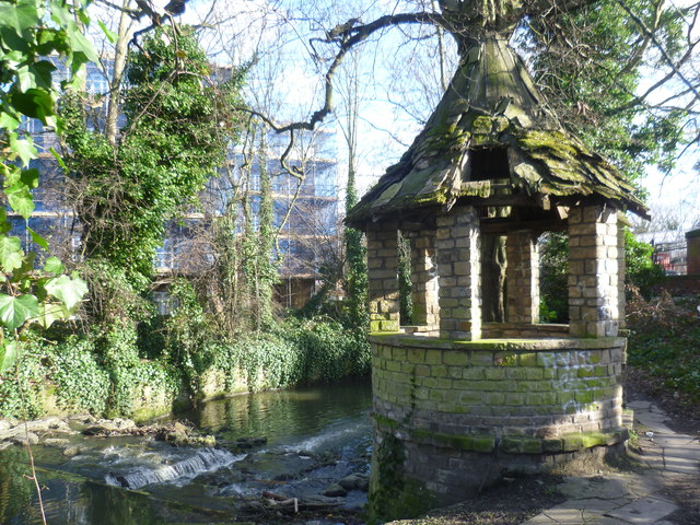
Old shelter in Brent Park alongside the River Brent
The Dollis Brook joins with the Mutton Brook near to the North Circular Road and just upriver of here to form the River Brent. Its route is followed by a thin strip of woodland along the riverbank and ribbon of open land on either side, providing a valuable green corridor. It is known as Brent Park. This shelter is just before the River Brent passes under Brent Street, which is just visible to the right. Sadly it has seen better days. The photograph is taken from the Capital Ring which follows the River Brent here.
 Map © Crown Copyright")
TIP: Click the map for more Large scale mapping
- Grid Square
- TQ2388, 248 images (more nearby 🔍)
- Photographer
- Marathon (more nearby)
- Date Taken
- Wednesday, 4 March, 2015 (more nearby)
- Submitted
- Thursday, 5 March, 2015
- Subject Location
-
OSGB36:
 TQ 2394 8846 [10m precision]
WGS84: 51:34.8829N 0:12.7586W - Camera Location
-
OSGB36: TQ 2393 8848
- View Direction
- South-southeast (about 157 degrees)