2015
J3775 : City Sightseeing bus, Belfast
taken 9 years ago, 4 km ENE of Belfast, Co Antrim, Northern Ireland
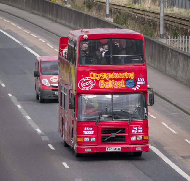
City Sightseeing bus, Belfast
A Volvo Olympian City Sightseeing bus on the Sydenham Bypass in Belfast (AXZ 6490, former Dublin bus). See also J3775 : Open-top bus, Sydenham bypass, Belfast (April 2014).
The Sydenham bypass, Belfast
Approximately 2½ miles of dual carriageway forming part of the Belfast Bangor Road. It runs from the end of the M3 to Tillysburn, parallel to the Belfast Bangor railway and also serves the George Best Belfast City Airport. It replaced the Holywood Road as the main road to Holywood and Bangor. There are plans for major improvements at the junction with Dee Street.
Loading map... (JavaScript required)
- Grid Square
- J3775, 1799 images (more nearby 🔍)
- Photographer
- Rossographer (more nearby)
- Date Taken
- Friday, 27 March, 2015 (more nearby)
- Submitted
- Monday, 30 March, 2015
- Subject Location
-
Irish:
 J 372 755 [100m precision]
WGS84: 54:36.5870N 5:52.5993W - Camera Location
-
Irish: J 371 755
- View Direction
- East-northeast (about 67 degrees)