NN6279 : Beauly - Denny power line access road
taken 9 years ago, near to Balsporran Cottages [other Features], Highland, Great Britain
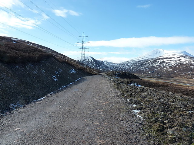
Scottish and Southern Energy is currently constructing a new 400kV overhead power line between Beauly, west of Inverness, to Denny in Stirlingshire, which it requires to strengthen the National Grid and enable the transmission of renewable energy from the Highlands to the more populous parts of the country. The proposal was hugely controversial not only for its own sake, because it involves the construction of a 220-kilometre line of 42-metre to 65-metre tall pylons through the heart of some of Scotland's finest scenery including the Cairngorms National Park, but also because the source of the power it will transmit is the controversial wind farms which are springing up all over the Highlands. The proposal attracted objections from 18,000 individuals and organisations, including every local authority on the route and every conservation organisation with an interest in Scotland, but was given planning approval in 2010 after a public inquiry. Among the conditions attached to the planning consent was the removal of the existing transmission line, with its 33-metre pylons, and the removal and in some cases burial of a further 109 kilometres of power lines elsewhere in Perthshire and Inverness-shire. Parts of the line are to be underground, but calls for the whole line to be underground, or even under the sea, were rejected. Press comment on the project has not been favourable. See Link
and Link
 Map © Crown Copyright")
- Grid Square
- NN6279, 52 images (more nearby 🔍)
- Photographer
- Richard Law (more nearby)
- Date Taken
- Friday, 27 March, 2015 (more nearby)
- Submitted
- Friday, 3 April, 2015
- Subject Location
-
OSGB36:
 NN 6297 7902 [10m precision]
WGS84: 56:52.9352N 4:15.0245W - Camera Location
-
OSGB36: NN 62985 79064
- View Direction
- South-southwest (about 202 degrees)