SH5281 : The Ship Inn
taken 9 years ago, near to Red Wharf Bay, Isle of Anglesey/Sir Ynys Mon, Wales
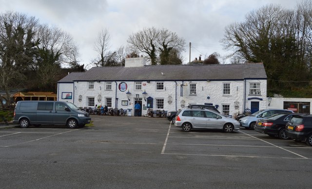
Traeth Coch (Welsh for Red Beach) is a wide sandy bay and an area of outstanding natural beauty on the east coast of the island of Anglesey in Wales. The bay is also known in English as Red Wharf Bay and lies between the villages of Pentraeth and Benllech. It is also close to Castell Mawr Rock, thought to be the site of an Iron Age fort.
Red Wharf Bay beach itself has an immense expanse of sand, at low tide almost 10 sq miles of sand is uncovered. The sand and the sea life disappears beneath the waves twice a day, and reappears just a few hours later.
CAMRA (Campaign for Real Ale) publish an annual guide of about 5000 of the pubs in Britain serving consistently high quality real ale. All pubs in this collection have been regular entries & good beer is assured.
 Map © Crown Copyright")
- Grid Square
- SH5281, 68 images (more nearby 🔍)
- Photographer
- N Chadwick (more nearby)
- Date Taken
- Friday, 20 February, 2015 (more nearby)
- Submitted
- Friday, 3 April, 2015
- Subject Location
-
OSGB36:
 SH 5290 8101 [10m precision]
WGS84: 53:18.3329N 4:12.5448W - Camera Location
-
OSGB36: SH 5293 8099
- View Direction
- Northwest (about 315 degrees)