2015
SE9989 : Looking down on Keld Runnels Farm
taken 9 years ago, near to Suffield, North Yorkshire, England
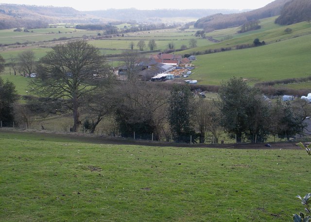
Looking down on Keld Runnels Farm
The embankment crossing the background is The Sea Cut which was opened in 1804. It runs from the River Derwent south of Wrench Green (in the far distance) and joins Scalby Beck near Scalby village and thence out to sea at Scalby Mills. It was designed to relieve the River Derwent of floodwaters and protect the villages and agricultural land in the Vale of Pickering from flooding. The valley that the Sea Cut follows is the pre-glacial route of what is now called the Derwent.
 Map © Crown Copyright")
TIP: Click the map for more Large scale mapping
- Grid Square
- SE9989, 36 images (more nearby 🔍)
- Photographer
- Christopher Hall (more nearby)
- Date Taken
- Saturday, 4 April, 2015 (more nearby)
- Submitted
- Tuesday, 7 April, 2015
- Subject Location
-
OSGB36:
 SE 990 896 [100m precision]
WGS84: 54:17.5726N 0:28.7646W - Camera Location
-
OSGB36: SE 992 901
- View Direction
- South-southwest (about 202 degrees)