2015
SE1952 : Swinsty Reservoir weir and outflow
taken 9 years ago, near to Jack Hill, North Yorkshire, England
This is 1 of 14 images, with title starting with Swinsty Reservoir in this square
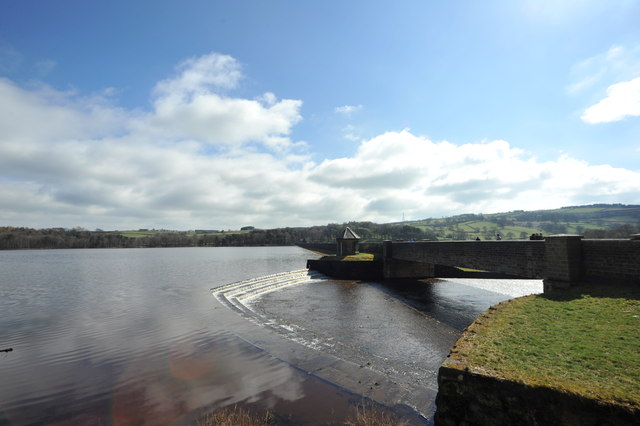
Swinsty Reservoir weir and outflow
The horseshoe weir which controls the level of Swinsty Reservoir in the Washburn Valley. There are four reservoirs in this valley: Thruscross (which has a drowned village in its depths, the remains of which are visible when the water level is very low: the last time I saw it in the early 1990s, the arch of the bridge was still standing and the remains of the church were visible), Fewston, Swinsty and Lindley Wood.
 Map © Crown Copyright")
TIP: Click the map for more Large scale mapping
- Grid Square
- SE1952, 73 images (more nearby 🔍)
- Photographer
- John Winder (more nearby)
- Date Taken
- Sunday, 5 April, 2015 (more nearby)
- Submitted
- Saturday, 11 April, 2015
- Subject Location
-
OSGB36:
 SE 1933 5283 [10m precision]
WGS84: 53:58.2710N 1:42.4085W - Camera Location
-
OSGB36: SE 1931 5284
- View Direction
- East-southeast (about 112 degrees)