2015
SE1523 : Cam Lane, Clifton
taken 9 years ago, near to Brighouse, Calderdale, England
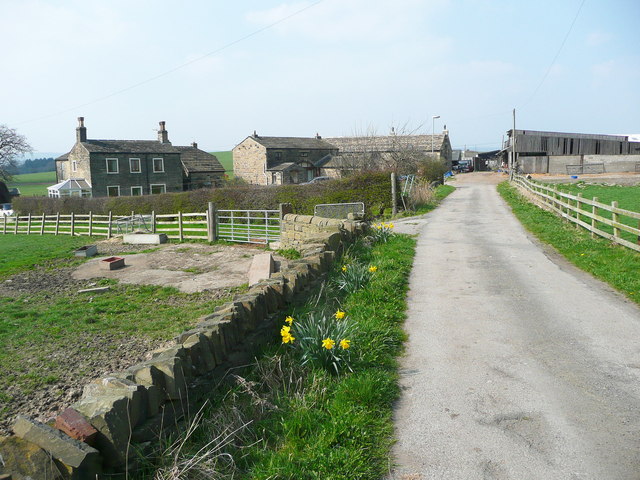
Cam Lane, Clifton
The lane is Brighouse FP70. It goes through Green Farm. The farmhouse is on the left and there are cattle sheds on the right. Between them a large house has been built.
 Map © Crown Copyright")
TIP: Click the map for more Large scale mapping
- Grid Square
- SE1523, 107 images (more nearby 🔍)
- Photographer
- Humphrey Bolton (more nearby)
- Date Taken
- Thursday, 9 April, 2015 (more nearby)
- Submitted
- Sunday, 12 April, 2015
- Subject Location
-
OSGB36:
 SE 1577 2342 [10m precision]
WGS84: 53:42.4183N 1:45.7547W - Camera Location
-
OSGB36: SE 1577 2342
- View Direction
- North-northwest (about 337 degrees)