2015
ST0594 : End of the elevated pavement, Clydach Road, Ynysybwl
taken 9 years ago, near to Ynysybwl, Rhondda Cynon Taf, Wales
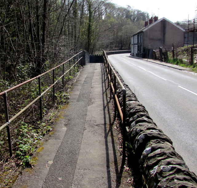
End of the elevated pavement, Clydach Road, Ynysybwl
The slightly elevated pavement is between the B4273 Clydach Road and a stream, Nant Clydach.
 Map © Crown Copyright")
TIP: Click the map for more Large scale mapping
- Grid Square
- ST0594, 56 images (more nearby 🔍)
- Photographer
- Jaggery (more nearby)
- Date Taken
- Thursday, 16 April, 2015 (more nearby)
- Submitted
- Saturday, 18 April, 2015
- Subject Location
-
OSGB36:
 ST 0594 9462 [10m precision]
WGS84: 51:38.5492N 3:21.6427W - Camera Location
-
OSGB36: ST 0592 9464
- View Direction
- Southeast (about 135 degrees)