2015
ST3530 : Parrett and Tone
taken 9 years ago, near to Burrowbridge, Somerset, England
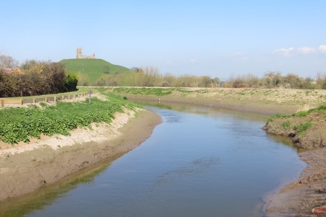
Parrett and Tone
Looking down the Tone from Stanmoor Bridge towards Burrow Mump and the confluence with the Parrett. There is evidence of repairs to the levees and dredging after the catastrophe of 2014.
 Map © Crown Copyright")
TIP: Click the map for more Large scale mapping
- Grid Square
- ST3530, 136 images (more nearby 🔍)
- Photographer
- Richard Webb (more nearby)
- Date Taken
- Monday, 6 April, 2015 (more nearby)
- Submitted
- Monday, 20 April, 2015
- Subject Location
-
OSGB36:
 ST 3583 3017 [10m precision]
WGS84: 51:4.0356N 2:55.0309W - Camera Location
-
OSGB36: ST 3580 3015
- View Direction
- Northeast (about 45 degrees)