2015
TF7336 : WW1 air raid shelter (interior)
taken 9 years ago, near to Sedgeford, Norfolk, England
This is 1 of 2 images, with title WW1 air raid shelter (interior) in this square
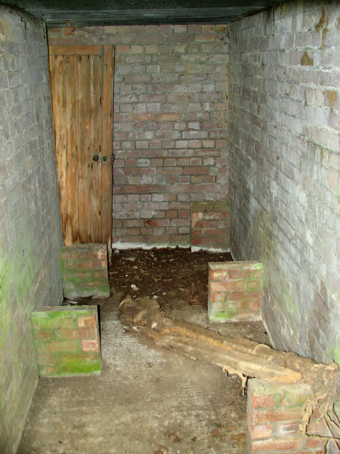
WW1 air raid shelter (interior)
For an exterior view see > Link. During WW1 this area formed part of the Sedgeford aerodrome which in WW2 was one of the dummy airfield sites created by the RAF.
RAF Sedgeford
RAF Sedgeford was opened in 1915 and used by the Royal Naval Air Force (RNAF) and the Royal Flying Corps (RFC), to be amalgamated in 1918 into the Royal Air Force (RAF), for the duration of WW1. In 1921, the land occupied by the aerodrome was sold and it soon returned to agriculture. In 1940 the few remaining buildings formed part of a decoy airfield created by the RAF for the protection of the nearby aerodrome at Bircham Newton. The site was closed for good in August 1942. See also > Link
(Please note that the site is located on private land and should therefore be visited only by the owner's permission.)
 Map © Crown Copyright")
TIP: Click the map for more Large scale mapping
- Grid Square
- TF7336, 51 images (more nearby 🔍)
- Photographer
- Evelyn Simak (more nearby)
- Date Taken
- Sunday, 26 April, 2015 (more nearby)
- Submitted
- Monday, 27 April, 2015
- Subject Location
-
OSGB36:
 TF 7302 3646 [10m precision]
WGS84: 52:53.8641N 0:34.2469E - Camera Location
-
OSGB36: TF 7303 3645
- View Direction
- Northwest (about 315 degrees)