2015
NY3856 : Hadrian's Wall Path, Carlisle
taken 9 years ago, near to Carlisle, Cumbria, England
This is 1 of 2 images, with title Hadrian's Wall Path, Carlisle in this square
Hadrian's Wall Path, Carlisle
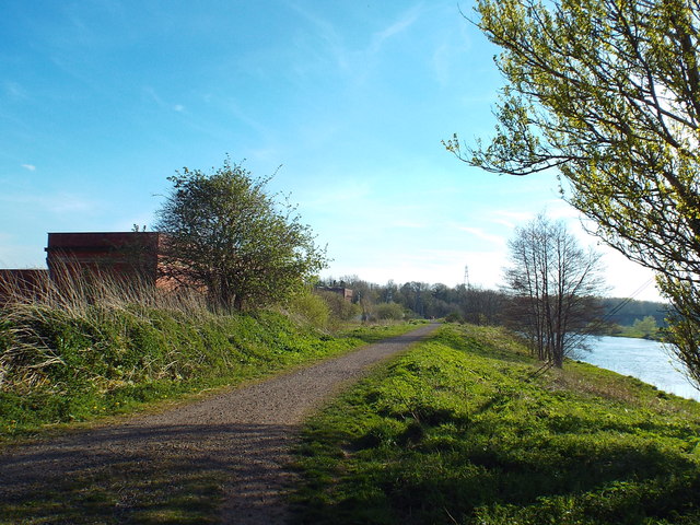
This path, along the bank of the River Eden, forms part of Hadrian's Wall Path. Hadrian's Wall Path is a long distance footpath following the route of Hadrian's Wall, across the north of England.
More information about the path can be found here: Link
More information about the path can be found here: Link
River Eden (Cumbria)
The River Eden rises high in the North Pennines and flows 90 miles northwards to meet the Solway Firth. The lower part of its valley is called the Vale of Eden.
Wikipedia: Link
Hadrian's Wall
Hadrian's wall or 'Vallum Aelium' is the remains of a large Roman fortification. The wall extended west from Segedunum at Wallsend on the River Tyne to the shore of the Solway Firth, ending a short but unknown distance west of the village of Bowness-on-Solway. Construction probably started sometime in AD 122 and was largely completed within six years.
The remains were made a UNESCO World Heritage Site in 1987.
 Map © Crown Copyright")
TIP: Click the map for more Large scale mapping
- Grid Square
- NY3856, 81 images (more nearby 🔍)
- Photographer
- Malc McDonald (more nearby)
- Date Taken
- Thursday, 23 April, 2015 (more nearby)
- Submitted
- Tuesday, 28 April, 2015
- Subject Location
-
OSGB36:
 NY 3866 5677 [10m precision]
WGS84: 54:54.1122N 2:57.4855W - Camera Location
-
OSGB36: NY 3867 5679
- View Direction
- Southwest (about 225 degrees)