2015
TA1968 : Limekiln Lane
taken 9 years ago, near to Sewerby, East Riding of Yorkshire, England
This is 1 of 5 images, with title Limekiln Lane in this square
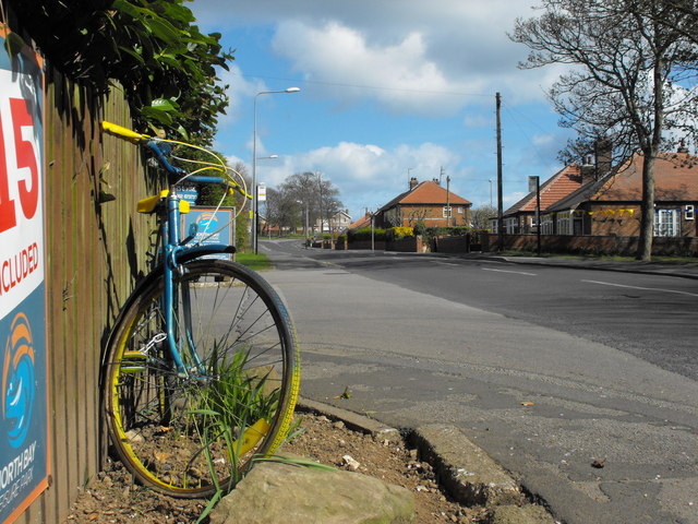
Limekiln Lane
Tour de Yorkshire Route 2015 - heading north.
Tour de Yorkshire 2015
The Tour de Yorkshire is a three day stage race, which begins in Bridlington on 1 May 2015.
It is seen as rewarding Yorkshire for the splendid hosting of the first two stages of the previous year's Tour de France - visiting areas not featured in that race.
Some of the world's best riders including 2012 Tour de France winner Sir Bradley Wiggins will be taking part.
Much of the route is marked with yellow and blue bicycles and bunting, displayed on lamp posts, trees, houses and businesses along the way (and also places not on the actual route).
![Creative Commons Licence [Some Rights Reserved]](https://s1.geograph.org.uk/img/somerights20.gif)


TIP: Click the map for more Large scale mapping
- Grid Square
- TA1968, 776 images (more nearby 🔍)
- Photographer
- JThomas (more nearby)
- Date Taken
- Tuesday, 28 April, 2015 (more nearby)
- Submitted
- Wednesday, 29 April, 2015
- Subject Location
-
OSGB36:
 TA 1930 6829 [10m precision]
WGS84: 54:5.8012N 0:10.6335W - Camera Location
-
OSGB36: TA 19304 68258
- View Direction
- NORTH (about 0 degrees)


