2015
ST3332 : Crossway Farm, Moorland
taken 9 years ago, near to Northmoor Green or Moorland, Somerset, England
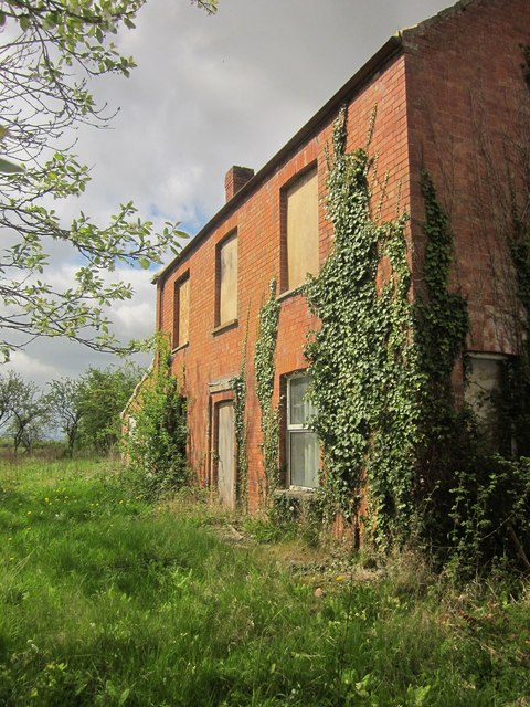
Crossway Farm, Moorland
There is planning permission to demolish this abandoned farmhouse and erect a five-bedroom property. ST3332 : Moorland : Crossway Farm also captures this building, from the other side, before it disappears. The Macmillan Way West and the River Parrett Trail run past.
 Map © Crown Copyright")
TIP: Click the map for more Large scale mapping
- Grid Square
- ST3332, 86 images (more nearby 🔍)
- Photographer
- Derek Harper (more nearby)
- Date Taken
- Saturday, 25 April, 2015 (more nearby)
- Submitted
- Thursday, 30 April, 2015
- Subject Location
-
OSGB36:
 ST 3357 3280 [10m precision]
WGS84: 51:5.4389N 2:56.9949W - Camera Location
-
OSGB36: ST 3358 3281
- View Direction
- Southwest (about 225 degrees)