2015
SU7396 : Bridge over the M40, Stokenchurch Gap
taken 9 years ago, near to Aston Rowant, Oxfordshire, England
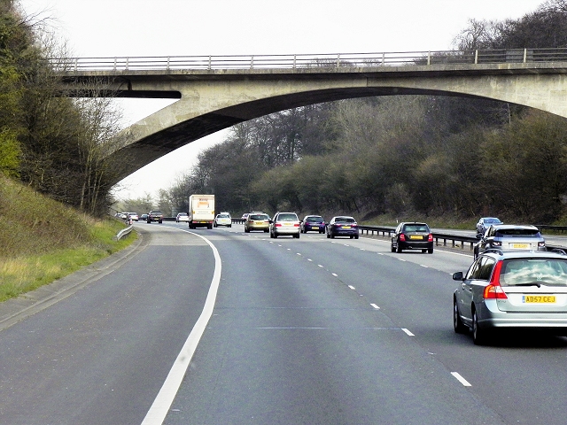
Bridge over the M40, Stokenchurch Gap
An elegant, concrete bridge spanning the M40 as it passes through the northwest escarpment of the Chilterns.
The M40 Motorway
The M40 Motorway runs for 89 miles, connecting the cities of London and Birmingham.
The motorway was built in two sections. The original M40 which was built between 1967 and 1974 ran from London to Oxford, bypassing the congested A40. In the late 1980s and early 1990s it was extended to join the M42 at Solihull in order to provide an alternative to the M1/M6 route between London and Birmingham; the final section being opened in January 1991.
 Map © Crown Copyright")
TIP: Click the map for more Large scale mapping
- Grid Square
- SU7396, 83 images (more nearby 🔍)
- Photographer
- David Dixon (more nearby)
- Date Taken
- Wednesday, 8 April, 2015 (more nearby)
- Submitted
- Tuesday, 5 May, 2015
- Subject Location
-
OSGB36:
 SU 737 964 [100m precision]
WGS84: 51:39.7094N 0:56.1090W - Camera Location
-
OSGB36: SU 736 964
- View Direction
- EAST (about 90 degrees)