2015
SK2680 : Burbage Brook
taken 9 years ago, 3 km from Nether Padley, Derbyshire, England
This is 1 of 7 images, with title Burbage Brook in this square
Burbage Brook
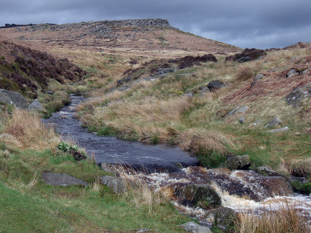
Burbage Brook higher reaches before it flows down Padley Gorge and into the River Derwent. Carl Wark Hill Fort can be seen in the background. Link (Archive Link )
 Map © Crown Copyright")
TIP: Click the map for more Large scale mapping
- Grid Square
- SK2680, 162 images (more nearby 🔍)
- Photographer
- Stephen Burton (more nearby)
- Date Taken
- Tuesday, 5 May, 2015 (more nearby)
- Submitted
- Wednesday, 6 May, 2015
- Subject Location
-
OSGB36:
 SK 26084 80805 [1m precision]
WGS84: 53:19.4118N 1:36.5919W - Camera Location
-
OSGB36: SK 2607 8077
- View Direction
- NORTH (about 0 degrees)