1962
SE0676 : Scar House Reservoir
taken 62 years ago, 4 km NW of Middlesmoor, North Yorkshire, England
This is 1 of 14 images, with title Scar House Reservoir in this square
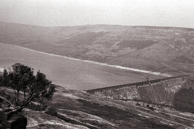
Scar House Reservoir
 Map © Crown Copyright")
TIP: Click the map for more Large scale mapping
- Grid Square
- SE0676, 93 images (more nearby 🔍)
- Photographer
- Peter Jeffery (more nearby)
- Date Taken
- August 1962 (more nearby)
- Submitted
- Tuesday, 2 June, 2015
- Subject Location
-
OSGB36:
 SE 0667 7690 [10m precision]
WGS84: 54:11.2697N 1:53.9571W - Camera Location
-
OSGB36: SE 0765 7663
- View Direction
- West-northwest (about 292 degrees)