2015
SN5321 : A40 at Pont Cellyn
taken 9 years ago, near to Llanarthne, Carmarthenshire/Sir Gaerfyrddin, Wales
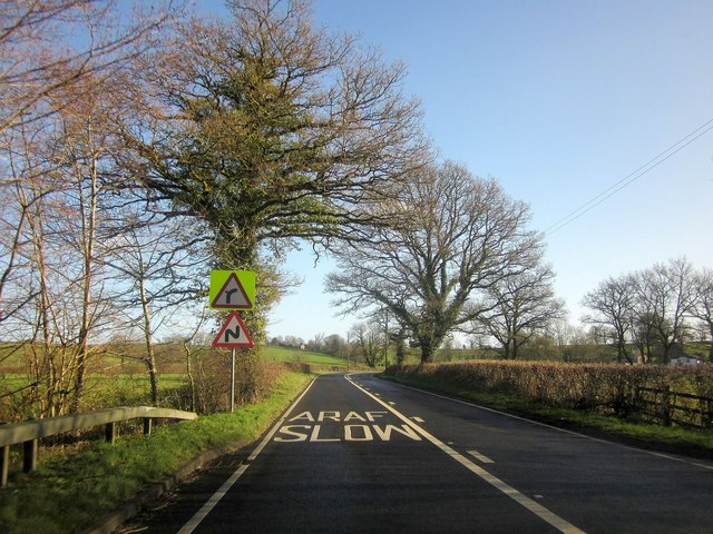
A40 at Pont Cellyn
There's very little sign of it here, but as the main road passes the tree, it crosses Nant Cellyn, a tributary of the Tywi. The slow sign is for a long double bend and two junctions ahead.
 Map © Crown Copyright")
TIP: Click the map for more Large scale mapping
- Grid Square
- SN5321, 21 images (more nearby 🔍)
- Photographer
- Derek Harper (more nearby)
- Date Taken
- Friday, 2 January, 2015 (more nearby)
- Submitted
- Friday, 19 June, 2015
- Subject Location
-
OSGB36:
 SN 532 215 [100m precision]
WGS84: 51:52.3619N 4:8.0270W - Camera Location
-
OSGB36: SN 5318 2154
- View Direction
- EAST (about 90 degrees)