SM8520 : The coast path overlooking Newgale Sands
taken 9 years ago, near to Newgale, Pembrokeshire/Sir Benfro, Wales
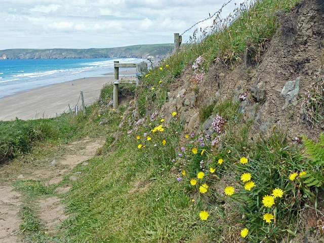
The Wales Coast Path (Welsh: Llwybr Arfordir Cymru) is a long distance footpath which follows the whole of the coastline of Wales. It opened on 5 May 2012, and offers a 870 mile long route from Chepstow in the south to Queensferry in the north.
Wales is the first country in the world to provide a dedicated footpath along its entire coastline. The Path runs through eleven National Nature Reserves and other nature reserves, including those managed by The Wildlife Trusts or Royal Society for the Protection of Birds (RSPB).
Logo can be seen atSS0897 : Logo, Wales Coast Path.
Website: Link
The Pembrokeshire Coastal Path (Welsh: Llwybr Arfordir Sir Benfro), is a designated National Trail. It is 186 miles long.
The southern end of the path is at Amroth. The northern end is St. Dogmaels. Here the path links with the Ceredigion Coast Path, which continues northwards.
The Pembrokeshire Coast Path forms part of the Wales Coast Path, an 870-mile long-distance walking route around the whole coast of Wales from Chepstow to Queensferry, which was officially opened in 2012.
 Map © Crown Copyright")
- Grid Square
- SM8520, 97 images (more nearby 🔍)
- Photographer
- Robin Drayton (more nearby)
- Date Taken
- Sunday, 21 June, 2015 (more nearby)
- Submitted
- Friday, 26 June, 2015
- Subject Location
-
OSGB36:
 SM 8543 2065 [10m precision]
WGS84: 51:50.5868N 5:6.9803W - Camera Location
-
OSGB36: SM 8545 2062
- View Direction
- Northwest (about 315 degrees)