2015
SE5223 : Disused wharf, Kellingley Colliery
taken 9 years ago, near to Kellingley, North Yorkshire, England
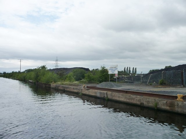
Disused wharf, Kellingley Colliery
On the north bank of the Aire & Calder Navigation. It has been announced that the pit will close in December 2015.
 Map © Crown Copyright")
TIP: Click the map for more Large scale mapping
- Grid Square
- SE5223, 67 images (more nearby 🔍)
- Photographer
- Christine Johnstone (more nearby)
- Date Taken
- Friday, 19 June, 2015 (more nearby)
- Submitted
- Thursday, 2 July, 2015
- Subject Location
-
OSGB36:
 SE 5233 2329 [10m precision]
WGS84: 53:42.2056N 1:12.5274W - Camera Location
-
OSGB36: SE 5235 2326
- View Direction
- Northwest (about 315 degrees)