2015
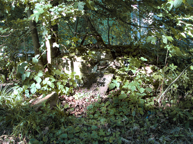
TM1873 : Bucket emptying platform (remains)
taken 9 years ago, near to Denham Street, Suffolk, England
This is 1 of 3 images, with title Bucket emptying platform (remains) in this square
Bucket emptying platform (remains)
During the war, the Communal site 2 of RAF Horham, which was an active airfield during WW2, used to be located here and this track lead to their latrine bucket emptying platform, the overgrown remains of which can be seen here. For a wider view see > Link. A bucket emptying platform is a small brick structure meant to assist in the emptying of chemical toilet containers used on many airfield camp sites during WW2 and later. At Horham the platform was connected to main sewage and did not require to be emptied manually.
RAF Horham (USAAF Station 119)
RAF Horham is located to the south-east of Eye and straddles the parishes of Denham, Horham, Redlingfield and Hoxne. Built for the Royal Air Force (RAF) it was one of the earliest heavy bomber bases opened in East Anglia. In 1942, the base was handed over to the United States Army Air Forces (USAAF) and designated Station 119. The aerodrome's history and a number of original buildings are preserved at two local museums - the 95th Bomb Group Hospital Museum > Link
and the nearby 95th Bomb Group Museum > Link
 Map © Crown Copyright")
TIP: Click the map for more Large scale mapping
- Grid Square
- TM1873, 81 images (more nearby 🔍)
- Photographer
- Evelyn Simak (more nearby)
- Date Taken
- Friday, 3 July, 2015 (more nearby)
- Submitted
- Friday, 3 July, 2015
- Subject Location
-
OSGB36:
 TM 1894 7310 [10m precision]
WGS84: 52:18.7398N 1:12.6300E - Camera Location
-
OSGB36: TM 1896 7311
- View Direction
- West-southwest (about 247 degrees)