2015
SH9124 : Cleavage, Craig yr Ogof
taken 9 years ago, near to Ty-Nant, Gwynedd, Wales
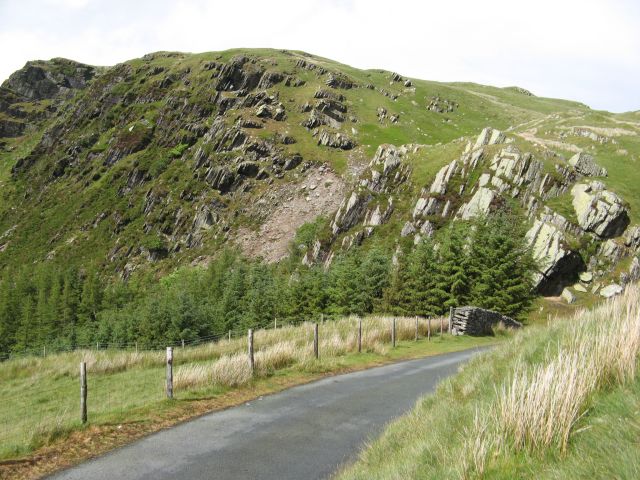
Cleavage, Craig yr Ogof
The dominant feature of the impressive crags named Craig yr Ogof is the impressive parallelism of the linear rock outcrops on the hillside above the road. While it is easy to assume that it is the strata of these Ordovician mudstones that is so well displayed in the centre-left of the image, it is a cleavage that is displayed. Cleavage is a tendency for the rock to split into slatey layers, caused by the growth of new minerals during metamorphism. The same cleavage orientation is developed in the crags towards the right of the image, but these also display the true bedding of the strata which dip to the right as shown by the grassy ledges. It is probable that a minor fault runs down the crags in the centre of the image, which accounts for the broken nature of the ground and the presence of a small stream (not visible).
 Map © Crown Copyright")
TIP: Click the map for more Large scale mapping
- Grid Square
- SH9124, 26 images (more nearby 🔍)
- Photographer
- Jonathan Wilkins (more nearby)
- Date Taken
- Sunday, 5 July, 2015 (more nearby)
- Submitted
- Sunday, 5 July, 2015
- Subject Location
-
OSGB36:
 SH 9143 2441 [10m precision]
WGS84: 52:48.3766N 3:36.7220W - Camera Location
-
OSGB36: SH 9139 2432
- View Direction
- North-northeast (about 22 degrees)