2015
SD9163 : Gordale Scar
taken 9 years ago, near to Malham, North Yorkshire, England
This is 1 of 10 images, with title Gordale Scar in this square
Gordale Scar
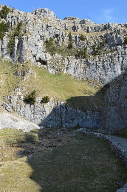
Gordale Scar is a dramatic limestone ravine 1.5km NE of Malham. It contains two waterfalls and has overhanging limestone cliffs over 100 metres high. The gorge could have been formed by water from melting glaciers or a cavern collapse. The stream flowing through the scar is Gordale Beck, which on leaving the gorge flows over Janet's Foss before joining Malham Beck two miles downstream to form the River Aire. A right of way leads up the gorge, but requires some mild scrambling over tufa at the lower waterfall.
See other images of Gordale Scar
See other images of Gordale Scar
 Map © Crown Copyright")
TIP: Click the map for more Large scale mapping
- Grid Square
- SD9163, 290 images (more nearby 🔍)
- Photographer
- N Chadwick (more nearby)
- Date Taken
- Tuesday, 7 April, 2015 (more nearby)
- Submitted
- Thursday, 9 July, 2015
- Subject Location
-
OSGB36:
 SD 9144 6395 [10m precision]
WGS84: 54:4.2846N 2:7.9381W - Camera Location
-
OSGB36: SD 9144 6392
- View Direction
- NORTH (about 0 degrees)