2014
TQ3783 : Marshgate Lane railway bridges
taken 10 years ago, near to Bow, Tower Hamlets, England
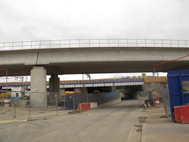
Marshgate Lane railway bridges
The near ere bridge carries the DLR re-routed to make way for Crossrail, and the further one carries National Rail services.
Docklands Light Railway (DLR)
The Docklands Light Railway is an automated light metro or light rail system opened on 31 August 1987 to serve the redeveloped Docklands area of London. It covers several areas of London, reaching north to Stratford, south to Lewisham, west to Tower Gateway and Bank in the City of London financial district, and east to Beckton, London City Airport and Woolwich Arsenal. It has been extended several times and now has 40 stations and carries over 60 million passengers a year.
Website: Link
Wikipedia: Link
 Map © Crown Copyright")
TIP: Click the map for more Large scale mapping
- Grid Square
- TQ3783, 501 images (more nearby 🔍)
- Photographer
- Stephen Craven (more nearby)
- Date Taken
- Sunday, 15 June, 2014 (more nearby)
- Submitted
- Saturday, 11 July, 2015
- Subject Location
-
OSGB36:
 TQ 3794 8359 [10m precision]
WGS84: 51:32.0622N 0:0.7573W - Camera Location
-
OSGB36: TQ 3794 8356
- View Direction
- NORTH (about 0 degrees)