SK3436 : Derby - Ashgate Primary School
taken 9 years ago, near to Derby, England
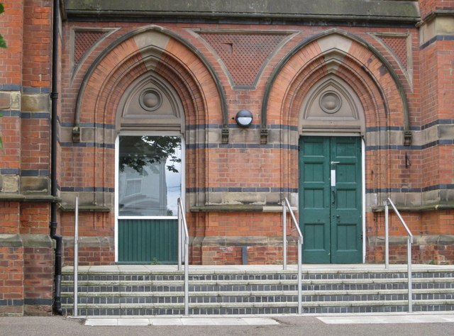
Ashgate Primary School was built on the south side of Derby's Ashbourne Road for the Derby School Board in 1879. It was built as a combined infant, junior and senior school.
The school was designed by Thomas Coulthurst and John Soames Storey, architects in Derby employed by the school board. Thomas Coulthurst was also the Surveyor for the Borough of Derby but worked privately for the Derby School Board. School boards were created in boroughs and parishes under the Elementary Education Act 1870. These boards were semi-independent of the borough and parish councils until they were abolished by the Education Act 1902, which replaced them with local education authorities (LEAs).
The building is listed as Grade II by English Heritage. The listing says that the school "is built from red brick with blue brick, moulded brick and ashlar dressings in a Gothic Revival Style". See Link, Link
Ashgate Primary School marks the west-most extent of the Friargate Conservation Area (see Link
 Map © Crown Copyright")
- Grid Square
- SK3436, 480 images (more nearby 🔍)
- Photographer
- Dave Bevis (more nearby)
- Date Taken
- Saturday, 11 July, 2015 (more nearby)
- Submitted
- Tuesday, 21 July, 2015
- Subject Location
-
OSGB36:
 SK 3400 3666 [10m precision]
WGS84: 52:55.5768N 1:29.7415W - Camera Location
-
OSGB36: SK 3401 3668
- View Direction
- South-southwest (about 202 degrees)