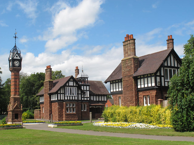
SJ6855 : Queen's Park: north gate lodges
taken 9 years ago, near to Wistaston Green, Cheshire East, England
"This park was given by the London & North Western Railway Co 1888 to commemorate the jubilee of her most gracious majesty Queen Victoria and the 50th anniversary of the opening of the Grand Junction Railway and was opened together with the Victoria Avenue by Field Marshal Commander in Chief HRH the Duke of Cambridge KG on the 9th of June 1888. F W Webb Mayor F Cooke Town Clerk"
Webb Link
The main public park for the town of Crewe was laid out from 1887 on land given by the London and North Western Railway Company, to mark both the 50th anniversary of its predecessor the Grand Junction Railway, and the Golden Jubilee of Queen Victoria. It opened in June 1888 and covers about 17 hectares. The park is elliptical in shape, surrounded by a carriage drive, and laid out quite formally. It was extensively restored c.2010. Facilities include a boating lake (formed from the Valley Brook, a minor tributary of the River Weaver), minigolf, cafe, children's playground and bandstand. At the centre of the park is a memorial to the fallen of the South African War of 1899-1902.
The official name is Queen's Park (the queen in question being Victoria) but locals also just call it Crewe Park.
 Map © Crown Copyright")
- Grid Square
- SJ6855, 69 images (more nearby 🔍)
- Photographer
- Stephen Craven (more nearby)
- Date Taken
- Sunday, 19 July, 2015 (more nearby)
- Submitted
- Wednesday, 22 July, 2015
- Subject Location
-
OSGB36:
 SJ 6879 5580 [10m precision]
WGS84: 53:5.9089N 2:28.0534W - Camera Location
-
OSGB36: SJ 6879 5578
- View Direction
- North-northwest (about 337 degrees)