NY3224 : Threlkeld Quarry & Mining Museum - quarry
taken 9 years ago, near to Threlkeld, Cumbria, England
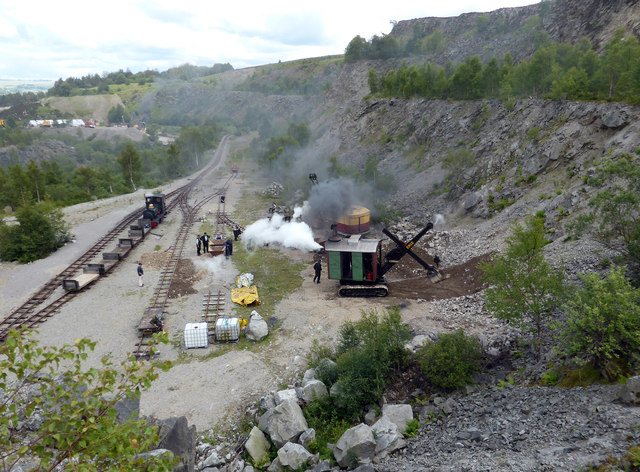
Threlkeld Quarry, which is situated three miles east of Keswick, originally opened in 1870 to supply railway ballast to the Penrith-Keswick line. Later, the stone was used by the Manchester Corporation Waterworks for their Thirlmere scheme, for railway ballast for the Crewe-Carlisle line, for roadstone, kerbing and for facing buildings with dressed stone. The granite quarry finally closed in 1982 and is now the site for the Threlkeld Quarry & Mining Museum which is run by a group of volunteers.
The extensive quarry site has ample space for the display of the unique collection of vintage excavators and old quarry machinery. The 2ft gauge mineral railway has been relaid and provides a ride into the inner quarry for visitors to view the quarry faces in safety.
LinkThrelkeld Quarry and Mining Museum
 Map © Crown Copyright")
- Grid Square
- NY3224, 198 images (more nearby 🔍)
- Photographer
- Chris Allen (more nearby)
- Date Taken
- Saturday, 25 July, 2015 (more nearby)
- Submitted
- Monday, 27 July, 2015
- Subject Location
-
OSGB36:
 NY 3269 2422 [10m precision]
WGS84: 54:36.5183N 3:2.6173W - Camera Location
-
OSGB36: NY 3259 2418
- View Direction
- East-northeast (about 67 degrees)