2015
SJ3388 : River Mersey, Monks Ferry Slipway
taken 9 years ago, near to Birkenhead, Wirral, England
This is 1 of 2 images, with title starting with River Mersey, Monks Ferry in this square
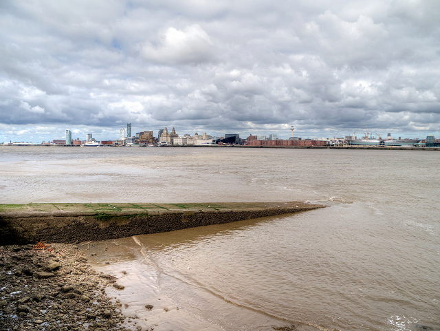
River Mersey, Monks Ferry Slipway
The area is named for the Monks of Birkenhead Priory who ran a ferry across to Liverpool in the twelfth century, This slipway dates from the nineteenth century, when it was used by the Monks Ferry Company who ran a service from 1838 until 1878. It was also used by tugs as a coaling berth Link (Archive Link ) .
Link History of the Mersey Ferries
Link
 Map © Crown Copyright")
TIP: Click the map for more Large scale mapping
- Grid Square
- SJ3388, 46 images (more nearby 🔍)
- Photographer
- David Dixon (more nearby)
- Date Taken
- Thursday, 30 July, 2015 (more nearby)
- Submitted
- Saturday, 1 August, 2015
- Subject Location
-
OSGB36:
 SJ 330 887 [100m precision]
WGS84: 53:23.4848N 3:0.4823W - Camera Location
-
OSGB36: SJ 330 887
- View Direction
- Northeast (about 45 degrees)