J3773 : Former Ulster Bank (Knock Branch), Belfast (August 2015)
taken 11 years ago, 4 km W of Dundonald, Co Down, Northern Ireland
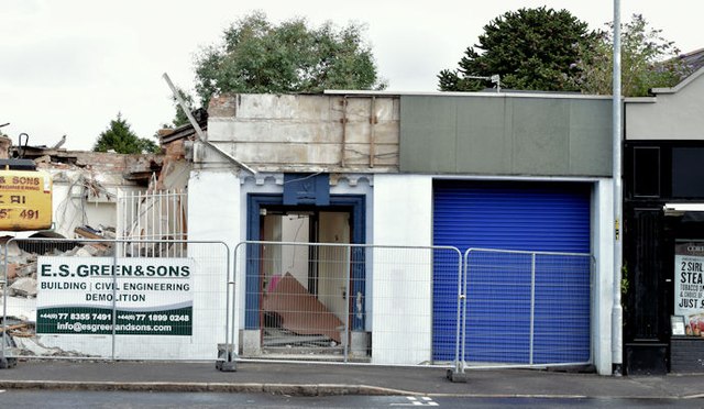
There is a short history of the Ulster Bank’s Knock branch in the grid square discussion on the left. Briefly it opened in 1925 as a sub-office of the Connswater branch J3674 : Former Ulster Bank (Connswater Branch), Belfast (1). The bank bought no 378 Upper Newtownards Road, then a private house known as “Sandiacre”', in October 1927 for conversion to a bank opening on 1 January 1930. It closed on 14 June 2013, as part of the cost cutting after the great worldwide banking crisis, with accounts transferred to Connswater J3674 : The Ulster Bank (Connswater Branch), Belfast. Following closure the premises (including the adjoining former manager’s house) were offered for sale. The photographs submitted by me appear as a matter of geographical and historical record only. I have no connection with the Ulster Bank or any of the parties involved in the sale and redevelopment.
The following application for planning permission: Z/2014/0938/F “376-378 Upper Newtwonards [sic] Road, Belfast Demolition of existing Class A2 buildings (bank) and erection of new building to comprise two units to be occupied by a coffee shop and a restaurant together with ancillary development” has been approved. The photographs submitted by me appear as a matter of neutral geographical and historical record only. I have no connection with the development.

- Grid Square
- J3773, 405 images (more nearby 🔍)
- Photographer
- Albert Bridge (more nearby)
- Date Taken
- Sunday, 2 August, 2015 (more nearby)
- Submitted
- Sunday, 2 August, 2015
- Subject Location
-
Irish:
 J 379 739
[100m precision]
WGS84: 54:35.7145N 5:52.0320W - Camera Location
-
Irish:
J 379 739
- View Direction
- North-northwest (about 337 degrees)


