2015
ST5590 : The Severn Bridge
taken 9 years ago, near to Beachley, Gloucestershire, England
This is 1 of 10 images, with title The Severn Bridge in this square
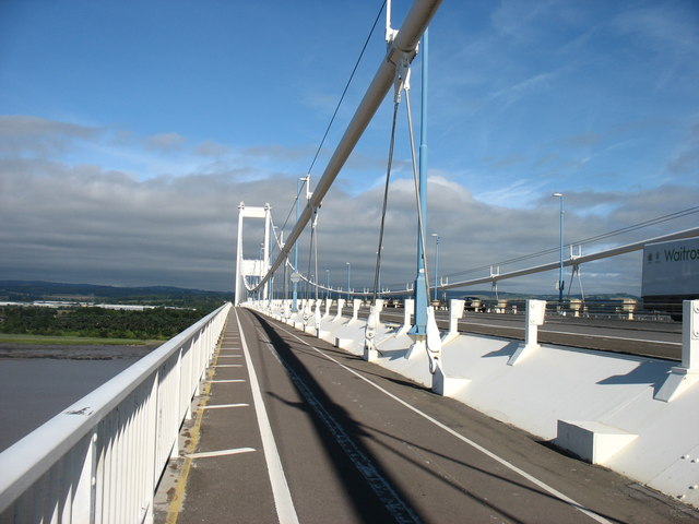
The Severn Bridge
On the footpath and cycle track on the south side of the bridge, approaching the centre of the main span which is (by a few metres) the highest point on the crossing.
 Map © Crown Copyright")
TIP: Click the map for more Large scale mapping
- Grid Square
- ST5590, 243 images (more nearby 🔍)
- Photographer
- David Purchase (more nearby)
- Date Taken
- Sunday, 9 August, 2015 (more nearby)
- Submitted
- Sunday, 9 August, 2015
- Subject Location
-
OSGB36:
 ST 5536 9055 [10m precision]
WGS84: 51:36.7200N 2:38.7643W - Camera Location
-
OSGB36: ST 5587 9021
- View Direction
- West-northwest (about 292 degrees)