2015
SJ8598 : Merrill Street, Holt Town
taken 9 years ago, near to Manchester, England
This is 1 of 3 images, with title starting with Merrill in this square
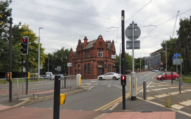
Merrill Street, Holt Town
The A662 from Droylsden. Since Merrill Street is now used by the Metrolink trams, bus services travel down Every Street on the left instead. The building on the corner was originally the District Bank.
 Map © Crown Copyright")
TIP: Click the map for more Large scale mapping
- Grid Square
- SJ8598, 725 images (more nearby 🔍)
- Photographer
- Gerald England (more nearby)
- Date Taken
- Wednesday, 5 August, 2015 (more nearby)
- Submitted
- Wednesday, 12 August, 2015
- Subject Location
-
OSGB36:
 SJ 8592 9844 [10m precision]
WGS84: 53:28.9493N 2:12.8183W - Camera Location
-
OSGB36: SJ 8596 9847
- View Direction
- West-southwest (about 247 degrees)