2015
SS8876 : Iron Age Hill Fort
taken 9 years ago, near to Ogmore, The Vale of Glamorgan/Bro Morgannwg, Wales
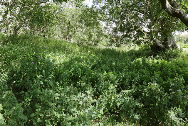
Iron Age Hill Fort
Dense summer vegetation fills the ditch which separates the two tree-lined mounds of this Iron Age Hill Fort. This feature protected the fort on its eastern boundary, with the steep hill of Kings Wood to the north and the deep valley with trackway to the south-west forming the other defenses which bound this triangular enclosure.
 Map © Crown Copyright")
TIP: Click the map for more Large scale mapping
- Grid Square
- SS8876, 148 images (more nearby 🔍)
- Photographer
- Alan Hughes (more nearby)
- Date Taken
- Saturday, 15 August, 2015 (more nearby)
- Submitted
- Sunday, 16 August, 2015
- Subject Location
-
OSGB36:
 SS 889 767 [100m precision]
WGS84: 51:28.6988N 3:36.0721W - Camera Location
-
OSGB36: SS 889 767
- View Direction
- North-northeast (about 22 degrees)