2015
TG4420 : Heigham Holmes drainage windpump
taken 9 years ago, near to West Somerton, Norfolk, England
This is 1 of 6 images, with title Heigham Holmes drainage windpump in this square
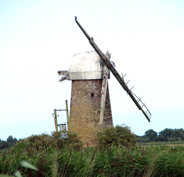
Heigham Holmes drainage windpump
Heigham Holmes is an isolated and little known area of marshland in the civil parish of Potter Heigham in North Norfolk. The area extends over about 500 acres and is bounded by the River Thurne in the south, Candle Dyke and Heigham Sound in the west, Meadow Dyke in the north and Eelfleet Wall in the east. Until well into the 19th century, the incumbent Lord Bishop of Norwich owned almost all of it, leasing parcels of land to tenants for an annual fee of £5.
Today Heigham Holmes is a nature reserve managed by the National Trust, who acquired it in 1987 and over the years restored it back to grassland by reinstating the old water levels and creating new dykes, pools and foot drains. It is described as a unique and internationally important wetland, comprising reed-fringed flood banks and open water, grazing marshes, scrub and wet woodland, interspersed by numerous dykes and pools characteristic of the Norfolk Broads landscape. Heigham Holmes is open to the public for only one day every year, with the only access being a floating, automated steel-decked bridge over the River Thurne, known as Martham Ferry > Link.
Rumour has it that during the Second World War part of Heigham Holmes was used by the Special Operations Executive (SOE) as a secret landing ground. No evidence has to date been found to substantiate this speculation.
See other images of Heigham Holmes
 Map © Crown Copyright")
TIP: Click the map for more Large scale mapping
- Grid Square
- TG4420, 70 images (more nearby 🔍)
- Photographer
- Evelyn Simak (more nearby)
- Date Taken
- Sunday, 16 August, 2015 (more nearby)
- Submitted
- Monday, 17 August, 2015
- Subject Location
-
OSGB36:
 TG 4497 2026 [10m precision]
WGS84: 52:43.4680N 1:37.5783E - Camera Location
-
OSGB36: TG 4509 2012
- View Direction
- Northwest (about 315 degrees)