2015
SJ8990 : A meeting of rivers and footpaths
taken 9 years ago, near to Stockport, England
A meeting of rivers and footpaths
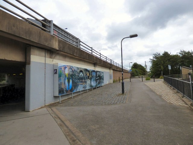
On the left is the footpath SJ8990 : Under the M60 alongside the River Tame under the M60. On the right the footpath crosses the River Goyt SJ8990 : The end of the Goyt. The two rivers join behind the camera to form the River Mersey SJ8990 : The very beginning of the River Mersey. A new mural SJ8990 : The Rivers Run Through was added to the wall supporting the motorway. The footpaths connect with both the Trans Pennine Trail and Fred Perry Way.
Fred Perry Way
The Fred Perry Way is a 14 mile walking route which runs from Woodford SJ8882 : Fred Perry Way in the south to Reddish SJ8994 : Fred Perry Way in the north. The route combines rural footpaths, quiet lanes and river valleys with urban landscapes and parklands. The route was officially opened in 2002.
Fred Perry was born in Portwood in 1909 SJ9091 : Fred Perry was born here. He won the men's singles in 1934, 1935 and 1936 and was the last English men's tennis player to win Wimbledon. He was also a member of Britain's winning Davis Cup team from 1933 to 1936. and was made a freeman of Stockport in 1934. Link
 Map © Crown Copyright")
TIP: Click the map for more Large scale mapping
- Grid Square
- SJ8990, 2240 images (more nearby 🔍)
- Photographer
- Gerald England (more nearby)
- Date Taken
- Monday, 10 August, 2015 (more nearby)
- Submitted
- Monday, 17 August, 2015
- Subject Location
-
OSGB36:
 SJ 8971 9085 [10m precision]
WGS84: 53:24.8613N 2:9.3766W - Camera Location
-
OSGB36: SJ 8969 9085
- View Direction
- EAST (about 90 degrees)