2015
TG1001 : Level crossing at Wymondham Abbey station
taken 9 years ago, near to Wymondham, Norfolk, England
This is 1 of 3 images, with title Level crossing at Wymondham Abbey station in this square
Level crossing at Wymondham Abbey station
The Lynn & Dereham Railway and the Norfolk Railway both obtained Parliaments permission to build lines to Dereham in 1845. The Norfolk Railway, building its line from Wymondham, reached Dereham first, and opened its railway to passengers on the 15th February 1847.
As a result of modernisation, the line witnessed its last scheduled steam-hauled passenger train on the 17th September 1955. Diesel units took over the next day, But steam-hauled freight continued into the early 1960s. By 1960 there was an hourly passenger service to Norwich. The increased use of road transport, led to a decline in passenger numbers, and it became one of the many railways to be threatened by the Beeching Report in 1963. In June 1965, the Wymondham to Dereham section was reduced to single track with a passing loop at Hardingham, and the service between Wymondham and Dereham ceased in October 1969.
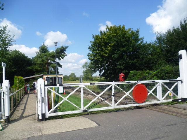
Although the Mid Norfolk Railway is physically connected to the Norwich to Cambridge line at Wymondham - see Link - it actually starts from Wymondham Abbey station (seen here beyond the crossing on Becketswell Road) for its 11+ mile run to Dereham. The ticket office is just beyond the passageway. It is hoped to extend the line to North Elmham and eventually to Fakenham. See Link (Archive Link ) and Link for much fuller histories.
As a result of modernisation, the line witnessed its last scheduled steam-hauled passenger train on the 17th September 1955. Diesel units took over the next day, But steam-hauled freight continued into the early 1960s. By 1960 there was an hourly passenger service to Norwich. The increased use of road transport, led to a decline in passenger numbers, and it became one of the many railways to be threatened by the Beeching Report in 1963. In June 1965, the Wymondham to Dereham section was reduced to single track with a passing loop at Hardingham, and the service between Wymondham and Dereham ceased in October 1969.
Although the Mid Norfolk Railway is physically connected to the Norwich to Cambridge line at Wymondham - see Link - it actually starts from Wymondham Abbey station (seen here beyond the crossing on Becketswell Road) for its 11+ mile run to Dereham. The ticket office is just beyond the passageway. It is hoped to extend the line to North Elmham and eventually to Fakenham. See Link
 Map © Crown Copyright")
TIP: Click the map for more Large scale mapping
- Grid Square
- TG1001, 342 images (more nearby 🔍)
- Photographer
- Marathon (more nearby)
- Date Taken
- Wednesday, 19 August, 2015 (more nearby)
- Submitted
- Friday, 21 August, 2015
- Subject Location
-
OSGB36:
 TG 1046 0142 [10m precision]
WGS84: 52:34.1921N 1:6.2477E - Camera Location
-
OSGB36: TG 1048 0140
- View Direction
- Northwest (about 315 degrees)